Points of InterestSome points of interest not on the circle tour are described in our printed tour route brochure including Eddy Narrows, Sloan Bridge Bluffs, and the Ninepipes Wildlife Refuge. Other points of interest in the local area are described here.
Big Fork Giant GroovesHuge grooves scrapped out of the rocks between the Swan Valley and Flathead Lake where an inter-montane glacier flowing north up the valley met a lobe of the stronger continental glacier flowing south from Canada and forced the ice west over the top of the Mission Mountains, smoothing off the peaks and creating 30ft and deeper gouges in the process. Located along the lake shore south of Big Fork but obscured by vegetation and best seen from the water or the air.
East Missoula Clay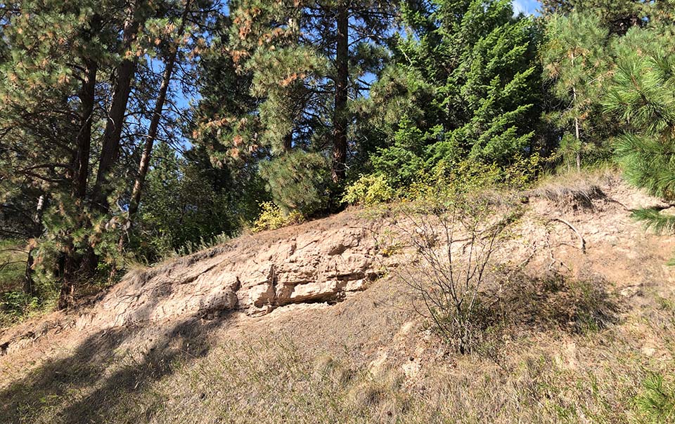
East Missoula Sediments
A large deposit of glacial lake silts and clays was created in a large eddy behind Mt Jumbo near the mouth of Hellgate Canyon. Numerous large boulders were deposited as seen in neighborhood yards in East Missoula, the Canyon River housing development, and the new Milltown State Park. In fact, a brickyard was established that used this clay in the early 1900's. Location: layered clay deposits can be seen against the base of Mt Jumbo and in the railroad cut near the entrance to the Deer Creek road. There are other glacial lake sediments in road and railroad cuts as you take I-90 to Gold Creek (near Drummond), the eastern extent of Glacial Lake Missoula.
Flathead Lake OverlookFlathead Lake was formed in a structural depression extending northward to Canada by the damming of the Flathead River by a giant glacial moraine. It is the largest natural freshwater lake west of the Mississippi River, now partially controlled by a hydro-electric dam at its southern end. During the era of Glacial Lake Missoula, the lake was probably a frozen block of ice abutting the mountains of Glacier National Park and the Mission Mountains. Located just south of Polson on Hwy 93 but can be accessed only from the northbound lanes.
Lone Rock School Erratic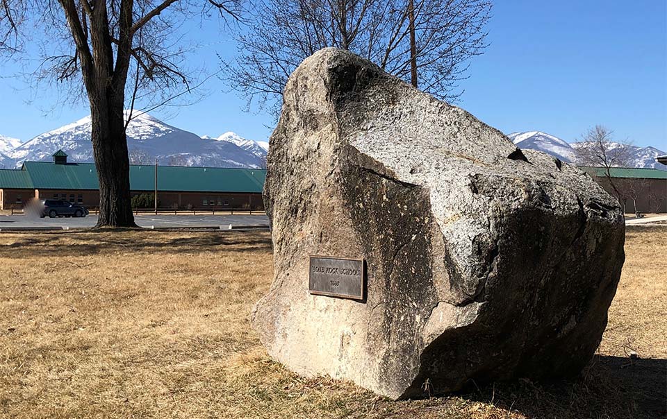
Lone Rock School Erratic
An 8.5 ton boulder moved from about ¾ miles south to commemorate the school’s centennial in 1985. It is made of quartz monzonite granite carried from glaciers in the Bitterroot Mountains all the way to the shores of Glacial Lake Missoula, where it floated away on a piece of ice, then settled to the valley floor when the water drained and ice melted. Located north of Stevensville off the Eastside Hwy (Co Rd 269). Turn right on Hwy 268 and travel a few miles to the school.
Ravalli County MuseumAn outdoor display tells the story of the ice age floods and the impact in this area. The display includes another large erratic found the area and moved to this location. Located at 205 Bedford Street in Hamilton.
St Regis OverlookThe tremendous volume of Glacial Lake Missoula water in the Clark Fork River draining through the Alberton Gorge along I-90 met the St Regis River flowing the opposite direction then carved its way back through high mountain valleys and scoured a path along what is now a scenic route towards the Flathead River at Paradise (MT 135). Hillsides of gravels, rocks, and huge boulders created by the giant churning of water can be seen in this area, Location of the overlook is east (right) from the four way stop in town, then left onto Mill Creek Road after crossing the bridge. Go about 3 miles through National Forest to a clearing at the top of the hill.
|
High Water MarkersMarkers indicating the high water level of Glacial Lake Missoula at 4200 ft have been placed at several locations, and more are planned. The locations in Missoula show the depth of the lake at about 1000 ft above the city. Other locations show the furthest extent of the floodwaters rather than the depth.
There is also a sign marking the high water level on Red Sleep Mountain Drive in the CSKT Bison Range. This is the only marker that can be reached by car that that indicates the depth of the lake. Directions to Missoula Markers Mt Sentinel One marker is above the “M” which is visible from the University of Montana campus. It can be reached by parking in the designated spaces in the lot at the foot of the trail off Campus Drive and following the zig-zag trail to the “M,” then circling on a trail to the left to go higher to join the Ridgeline Trail. Travel east a short distance to the marker. A second marker is located on the Pengelly Ridge Trail. The recommended access point for this trail is the trailhead at a small parking lot adjacent to a gravel pit off Pattee Canyon Road a few blocks east of the intersection with South Higgins. A fairly steep climb at the beginning levels off at the top and follows a path toward the summit. The marker is located not far along this trail. Mt Jumbo One marker is above the “L” visible from most places in Missoula. It can be reached from the Rattlesnake neighborhood north of the Interstate by parking at the trailhead where Cherry Street ends at the mountain. Follow the signs for the “L” Trail and after reaching it, follow the “L” to Jumbo Backbone Trail a short distance higher. The second marker is on the Mt. Jumbo Backbone Trail and is generally reached from a separate access point from the opposite direction as the “L” marker. The recommended trailhead is located at a small parking lot near the end of Lincoln Hills Drive, about 1.5 miles from where it intersects with Rattlesnake Drive. Stay to the right (south) where the trail divides not far from the beginning. Mt Dean Stone The newest marker placed in the Missoula area is closer to the South Hills. It is located on a spur off the Barmeyer Loop Trail, which begins at a small parking lot adjacent to 1355 Pattee Canyon Drive on the south side of the road. A more gradual access is from the Sousa Trailhead located off Spanish Peaks Drive. Markers outside Missoula Lake Como The furthest extent of Glacial Lake Missoula in the Bitterroot Valley arm southeast of Missoula is marked by a stone in the Bitterroot National Forest several miles north of Darby MT. The marker was placed at a parking area for the swimming beach near the dam which regulates Lake Como. Ovando Marks the end of the northeastern arm of Glacial Lake Missoula in the Blackfoot Valley. Located adjacent to the parking lot for Trixi's Antler Saloon near Ovando, a charming visitor friendly town. Gold Creek Three markers located close to I-90 near the Drummond rest area indicate the furthest extent east of Glacial Lake Missoula in the Clark Fork valley. One is at the fishing access at Gold Creek, exit 166, and two are found at Truck Stops in both the eastbound and westbound lanes within a few miles. GPS coordinates and more detailed instructions on reaching all of the markers can be found on the IAFI interactive map. Also, elevations are shown on maps from Missoula Parks and Recreation, and the intersections of trails with topographic lines is where the markers are located. Numerous unauthorized user trails are also found on these mountains.
|